Sunday, June 27, 2010

North to Alaska 2010

Skagway, AK

Skagway is an interesting town. It has a lot of old buildings that have been taken care of, refurbished with new businesses in them, but with the goldmining town look. Skagway has a population of 834 except when the cruise ships tie into port and then the population swells by 2,000 or more. Skagway is a bustling little town when the ships dock but they still roll up the sidewalks before 7:00 pm - most nights.


The name Skaguay - original spelling - is said to mean "stiffly wind rippled water" in Tlingit. In July 1897 the first boatloads of stampeders bound for the Klondike landed. By October 1897, according to a North West Mounted Police report, the town had grown to a population of about 20,000. By the summer of 1899 the stampede was all but over and Skagway's population dwindled to 500. But the small town held on and became an important port and a ferry terminal.


We went to the dock several times - whenever we would hear a cruise ship's horn just to see the docking procedure or the departure. Interesting how each one has their own way of coming into port. Some tie up nose in and then they have to back out into the bay and some of them turn around in the bay and come in backwards. Once they dock, hundreds of passengers depart to catch either the train or a bus to go north to Carcross.


The one very interesting thing in Skagway that wasn't a building was the rotary snowplow on display. This attached to the front end of the train to plow the snow off the tracks in the pass - on the track that went from Skagway to Whitehorse.


The first night there we discovered we had no electric in the RV. Ken spent almost the entire next day tracing down where the short was while I did the wash and read. Finally, he discovered that the electric brake wire that if the trailer disconnects from the hitch, it will lock up the trailer brakes was rubbing on the frame - thereby shorting out the electric in the RV. Electric is an essential item when you sleep with a C-PAP machine like Ken does. We were relieved to have that taken care of but didn't plan on spending an extra day in Skagway.

Skagway isn't very big, but we will explore what there is tomorrow then head for Whitehorse the next day.


Saturday, June 26, 2010

North to Alaska 2010

Teslin YT to Skagway, AK

From Teslin we are going to take a shortcut by traveling the Tagish/Atlin Highway. This will cut several miles off of our distance but . . . and that is a big but!! The highway is a mess. They are working on the frost heaves and the method of doing this is awful. First, they dig the chip seal out, then they lay gravel - lots of it. When they have the gravel graded, they flood it with calcium chloride - mixed in water - to make the gravel pack better and to help keep the dust down. This makes for one sloppy, slippery mess for someone traveling on it. If you pride yourself in having a clean vehicle - this is not the road for you. We have, in fact, found a few of these roads along the way so far.

We did not go to Atlin as it was out of our way, but we did go through Tagish - population 206. This little village is not very big, but it has a marina and several business that cater to the traveling public. Two miles south of Tagish on the Tagish River is Tagish Post, originally named Fort Sifton, the Canadian customs post established in 1897. The North West Mounted Police and Canadian customs collected duties on thousands of tons of freight carried by stampeders on their way to the Klondike goldfields between September 1897 and February 1898.

Next town is Carcross. This is a delightful little town - population 446. Carcross became a stopping place for gold stampeders on their way to the Kondike goldfields. It was a major stop on the White Pass & Yukon Route railroad from 1900 until 1982 when the railroad ceased through train service. There are several little shops in the buildings that still look as it did back in the "old" days. And there are new enterprises like Eddie's Check Point. Eddie runs a hamburger/hot dog stand out of a 5 x 9 shed with his personal gas grill out the back door. The burgers are big, juicy and really good. I asked Eddie what he does in the winter and he replied "mush". He runs sled dogs and enters every long distance race he can. Sounds like a good life to me. His wife works full time in a business in Tagish and his kids are mushers, too.

After lunch we headed south to Skagway. But first - we had to hide our meat. When we came through US Customs 4 years ago after the Maritime Provinces, the customs person, went through our freezer and refrigerator and confiscated every piece of meat we had that didn't have a US label on it because Alberta, Canada had just had a mad cow disease - or so she said. So this time, we emptied out the freezer and refrigerator of meat that wasn't correctly labeled US and hid it in bags beneath and behind our refrigerator. There is a dead space there that works just wonderful for that.

This road going south is absolutely incredible - the best scenery we have seen so far. Tagish Lake and its extension Windy Arm, are beautiful. There is evidence of mining and a stamp mill site is still standing which ties in with the Venus Mines concentrator which had a capacity of 150 tons per day. The mine closed in October 1981 due to the drop in silver prices. We passed a beautiful area called Tormented Valley, a rocky desolate "moonscape" of stunted trees and small lakes.


We finally arrive at the customs station - we answer all of the usual questions - how long were you in Canada, do you have anything to claim, any alcohol, guns, ammunition? We answered all of these and expected him to come out to inspect our refrigerator!! Wrong - he just waved us through with a "have a great vacation, folks" and sent us on our way. Whew - that was great but a lot of work for nothing. Next customs stop we won't do that and hope we are as lucky.

In Fraser - where the Canadian customs is, this area reportedly gets up to 24 feet of snow a year. They have snow poles posted on the highway so the snow plows can see where the road was before it got buried. Incredible. From here is was all down hill and I do mean down hill. The grade for the next 12.5 miles is at 11% which is pretty steep especially when you have 10,000 pounds behind your truck. We got down safely, found a campground and decided to stay put for the next couple of days in Skagway.


A few more on the road pictures:


Monday, June 21, 2010

North to Alaska 2010

Watson Lake to Teslin Lake, YT

First thing this morning we spotted a brown Black Bear. The Black Bears like to forage at this time of year along side the road where the new grass and plant shoots are nice and tender. When the grass gets a little tougher in July, the berries will be ready and they will switch to the berry bushes. We have been told that if we spot a berry bush stay away from it as the bears do not like to share the fruit or be interrupted while eating. Black Bears eat over 250,000 berries a day - and it is a good thing that every where you look there are berry bushes. In the fall the bears start eating the Low Bush Cranberries - what we know as Lingonberries. Not all bears eat salmon, but the ones that do are usually close to the salmon streams and Grizzlies are very prevelant when the "fish" are running. In Alaska, when someone refers to fish, they are talking about salmon - guess that is the important fish in this state.


We stopped at the Continental Divide Lodge for lunch today. Primarily because in the Mile Post it listed Rhubarb Pie as one of desserts they have there. That is Ken's favorite. This "restaurant" had 3 tables. Two of the tables sat 4 people and the other sat 6. Other than that, if there were more than 14 people, the extras would have to wait for an empty seat. The bar/lounge was unique in itself. It had the usual bar but the lounge had 2 sofas, 2 reclining chairs, a raised platform for an entertainer and when there wasn't live entertainment, there was a big screen tv on the platform. The front of the building was the counter to pay for gas, a few souveniers and a few snacks. Quite the place. The women running the restaurant were a hoot! One was from Whitehorse, a full time RN who worked 3 days a week at the hospital there and came to the Lodge to do all of their baking for them. The other woman lived in Alberta during the winters and worked at the lodge in the summertime. She made coffee and the water wouldn't drip through the grounds - this happened twice - and she had quite the mess. Two nicest women you ever saw but it was quite the experience. The rhubarb pie had just come from the oven so was quite warm, they didn't have any ice cream - that wouldn't be delivered until June 1st (it was May 26th) and they were just getting the place started that week.

Along this part of the highway are hundreds of names spelled out on the sides of the road with rocks. Some are very imaginative while others are just rocks. Also there are several "Inukshuks" - oringally rock cairns built by the Inuit as landmarks - left by travelers. We talked about "writing" our names, but it seemed like a lot of work to collect all the rocks, then climb the bank to write our names.

We passed over the Continental Divide which divides 2 of the largest drainage systems in North America - the Yukon River and Mackenzie River watersheds.

After getting to our campsite in Teslin Lake, we headed over to theTeslin Tlingit Heritage Center but as it was almost 5 o'clock and they were closing we only got to look at the Totem Poles outside the center. The Tlingit tribe pronounce their name as Klinkit. The 5 outdoor totems represent the Wolf, Eagle, Fron, Beaver and Raven clans.


Skagway will be our destination for tomorrow. Here are a few more pictures to finish the day.


Saturday, June 19, 2010

North to Alaska 2010

Racing River Bridge to Watson Lake, YT

It was with reluctance that we left this morning. The last two days have been wonderful - beautiful scenery, wildlife, the river and relaxation. The first time we have stayed more than one night since we left. We really needed a break from traveling.

We are on our way to Watson Lake and the Sign Post Forest. And as has been the case, the scenery is awesome. We are passing through an area that is named "Folded Mountain" and it is unbelievable that a pile of rock could wind up in this configuration. According to the Mile Post, Originally, all of the rock of the Canadian Rockies lay flat on the shallow sea bed of the western continental shelf. About 175 million years ago, the continent of North America began to move westward, overriding the Pacific floor and colliding with offshore islands. The continental shelf was caught in the squeeze and the flat layers slowly buckled into folds. By 120 millions years ago, the Rockies were showing above the sea. They grew for another 75 million years, rising faster than erosion could tear them down reaching Himalayan heights. Active mountain building ended in the Canadian Rockies some 45 million years ago and the peaks have since been eroded to a small fraction of their original size. Believe me - even after all that time eroding they are still huge!!!


Animal count today - 7 Stone Sheep - they look like any other mountain sheep except they are not white - they are tan, black with white mixed in - 8 Bison, 2 Black Bear and 2 Moose.


We passed by Muncho Lake, which is outstanding. This lake is know for its beautiful deep green and blue waters. It is 7 miles in length and 1 mile in width. The colors are attributed to copper oxide leaching into the lake.


Once we reached Watson Lake and got into the campground, we went for a ride to find the Sign Post Forest. People have been coming here for years and leaving signs on posts with names and cities and dates when they were there. It was started by a U.S. Army soldier working on the construction of the Alaska Highway ina 1942. The latest count is more than 61,000 signs - and we added ours to increase the number by one.

As you can see, our sign is nothing fancy - but you can tell we were there and that is what counts.
Tomorrow we will continue on our way towards Skagway, AK for a side trip.


Friday, June 18, 2010

North to Alaska 2010

Fort Nelson to the Racing River Bridge

As we traveled today we passed many turn outs with magnificent views and stopped at a few and by-passed a couple of them altogether. The terrain is becoming hillier and the mountains are still snow capped.


We did see a few animals - Bison (they were on a Bison Ranch), 2 Black Bear and 2 Caribou. They don't seem to mind onlookers - they just continue to graze alongside the highway, minding their own business. They will stop and take a look, but they certainly don't get too excited about the humans gawking at them. And we do gawk!!


At one point today - and it became our final stop for the day - we reached the turnout just before the Racing River. As we drove off the road, we spotted a Motor Home going further on beyond the turnout over by the river so we followed him. He had backed in as if he was going to spend the night there so we thought - what's one more RV? I asked him if they were going to spend the night and he said no, they needed to get back to Grande Prairie and were only stopping to take a few pictures and for his wife to collect some rocks. After they left, we noticed that where they had parked was a gravel jetty made for someone - a fisherman - to back his truck out so he had easier access to the water. Great - Ken said we would fit and promptly backed the trailer onto the jetty and there we were - beautiful view of the river, the mountain slope across the river and unless you were looking for us, we couldn't be seen by the northbound traffic and only a cursory glimpse from the southbound traffic. Great spot. In fact, it was so great, we stayed two nights there and really hated to leave it at all. We didn't do much except relax, read, keep track of the wildlife on the slope and have a good time.


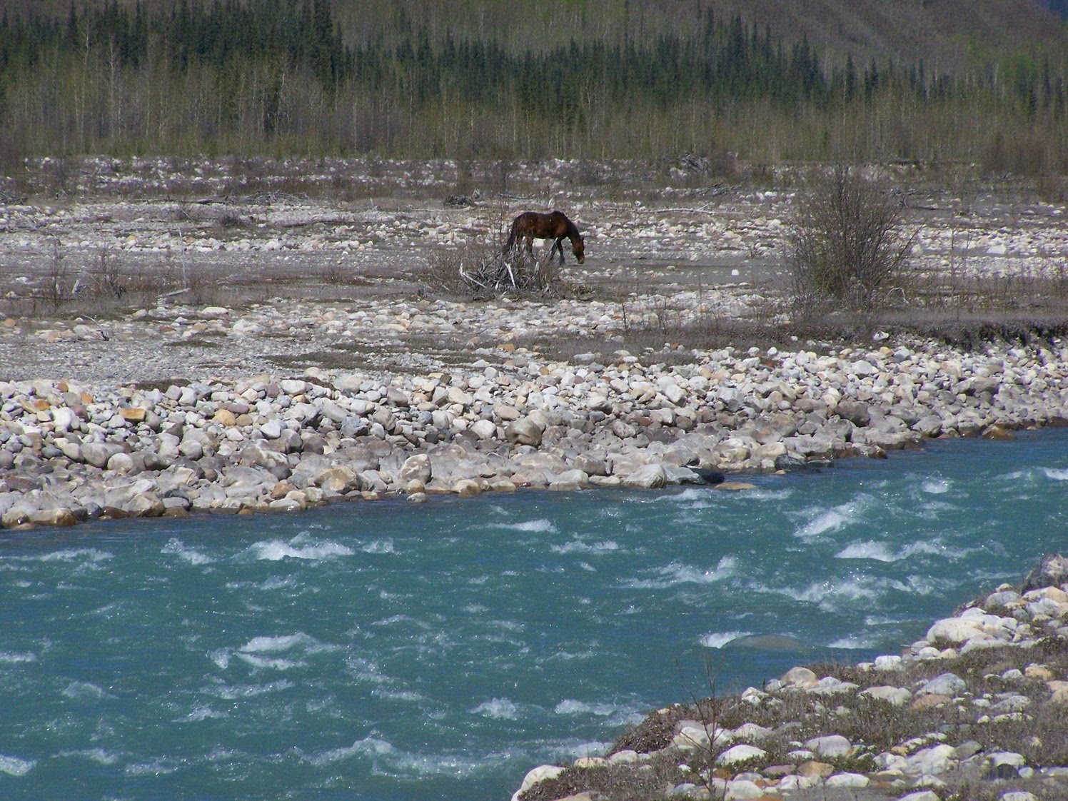
The water is aqua colored - from the glacier run-off and the rock flour they create - and when they named it the Racing River, they were really on top of it. This river is so fast, it is unbelievable. I don't think it would be a good waterway for white water or kayaking. At least not for someone without expert experience.


Gray Jays are abundant. Two of them had to check out what Ken was doing when he was getting ready to grill something outdoors. He had to come in to get something and couldn't leave or they would have grabbed what they could and run with it. So while he came in I went out and the birds were not happy about it at all. They flew back into the tree and chewed us out royally. Later in the day we noticed there were horses on the slope, then caribou, and in another area was a Moose - and after the caribou, elk. The second day, they seemed to rotate. When the horses would disappear, then something else would appear for awhile. Interesting but strange.

Pine Siskins - little birds - came the next day to entertain us. They are small and very noisy. Two of them just sat in the tree and chattered most of the day.

It was a great two days, and we hated to leave - but we hear Alaska still calling our names. Tomorrow we will head for Watson Lake - in the Yukon Territory.


More pictures: